

Updated geologic maps of Marcellus Shale show more detail of shale formation
Saturday, April 4, 2015
The Energy Information Administration has updated its maps of the Marcellus Shale formation, as reported by PennEnergy.
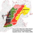
The updated maps show the formation’s structure, thickness and the play’s extent. Structure and thickness maps are needed to determine where hydrocarbon extraction is economical. Well data is used to create the maps.
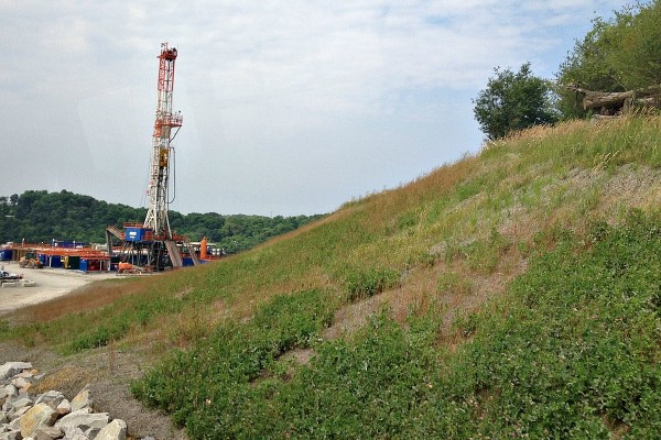
The Marcellus Shale is currently producing in Pennsylvania, Ohio, West Virginia and New York, although drilling has been suspended and more recently banned in New York.
Via: PennEnergy > Updated geologic maps provide greater detail for Marcellus formation
Leave a Comment
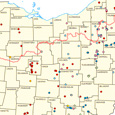
Marcellus & Utica Shale Well Map
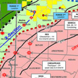
Additional Shale Maps
Shale FAQ
What are mineral rights?
Mineral rights are the rights of the owner of the property to mine or produce any resources below the surface of the property. Mineral rights are different from surface rights.
Will I get free natural gas if I allow fracking on my property?
Maybe. It depends on your particular lease agreement. Some companies allow property owners a yearly free gas allowance. But, the process of connecting your property to the gas source may be more complicated. Some companies will provide a hookup, others require the landowner to provide one.